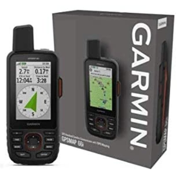
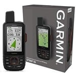
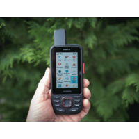
Precise navigation meets global communication in the rugged GPSMAP 66i button-operated GPS handheld and satellite communicator1 featuring Garmin TopoActive mapping and inReach® technology.
General |
| PHYSICAL DIMENSIONS | 6.6 x 16.3 x 3.5 cm |
|---|
| DISPLAY SIZE | 3.8 x 6.3 cm; 3" diag (7.6 cm) |
|---|
| DISPLAY RESOLUTION | 240 x 400 pixels |
|---|
| DISPLAY TYPE | Transflective colour TFT |
|---|
| WEIGHT | 241 g |
|---|
| BATTERY TYPE | rechargeable lithium-ion |
|---|
| BATTERY LIFE | Up to 35 hours at 10-minute tracking; up to 200 hours at 30-minute tracking (power save mode) |
|---|
| WATER RATING | IPX7 |
|---|
| MIL-STD-810 | yes (thermal, shock, water) |
|---|
| HIGH-SENSITIVITY RECEIVER | Yes |
|---|
| INTERFACE | high speed micro USB and NMEA 0183 compatible |
|---|
| MEMORY/HISTORY | 16GB |
|---|
Maps & Memory |
| PRELOADED MAPS | Yes (topographic) |
|---|
| ABILITY TO ADD MAPS | Yes |
|---|
| BASEMAP | Yes |
|---|
| AUTOMATIC ROUTING (TURN BY TURN ROUTING ON ROADS) | Yes |
|---|
| MAP SEGMENTS | 15000 |
|---|
| BIRDSEYE | yes (direct to device) |
|---|
| INCLUDES DETAILED HYDROGRAPHIC FEATURES (COASTLINES, LAKE/RIVER SHORELINES, WETLANDS AND PERENNIAL AND SEASONAL STREAMS) | Yes |
|---|
| INCLUDES SEARCHABLE POINTS OF INTERESTS (PARKS, CAMPGROUNDS, SCENIC LOOKOUTS AND PICNIC SITES) | Yes |
|---|
| DISPLAYS NATIONAL, STATE AND LOCAL PARKS, FORESTS, AND WILDERNESS AREAS | Yes |
|---|
| EXTERNAL MEMORY STORAGE | microSD™ card (not included) |
|---|
| WAYPOINTS/FAVORITES/LOCATIONS | 10,000 |
|---|
| TRACKS | 250 |
|---|
| TRACK LOG | 20,000 points, 250 saved gpx tracks, 300 saved fit archives |
|---|
| ROUTES | 250 |
|---|
| RINEX LOGGING | Yes |
|---|
Sensors |
| GPS | Yes |
|---|
| GALILEO | Yes |
|---|
| BAROMETRIC ALTIMETER | Yes |
|---|
| COMPASS | Yes (tilt-compensated 3-axis) |
|---|
| GPS COMPASS (WHILE MOVING) | Yes |
|---|
Daily Smart Features |
| CONNECT IQ™ (DOWNLOADABLE WATCH FACES, DATA FIELDS, WIDGETS AND APPS) | Yes |
|---|
| WEATHER | Yes |
|---|
| VIRB® REMOTE | Yes |
|---|
| PAIRS WITH GARMIN CONNECT™ MOBILE | Yes |
|---|
| ACTIVE WEATHER | Yes |
|---|
| SMART NOTIFICATIONS ON HANDHELD | Yes |
|---|
Safety and Tracking Features |
| LIVETRACK | Yes |
|---|
Outdoor Recreation |
| POINT-TO-POINT NAVIGATION | Yes |
|---|
| COMPATIBLE WITH BASECAMP™ | Yes |
|---|
| AREA CALCULATION | Yes |
|---|
| HUNT/FISH CALENDAR | Yes |
|---|
| SUN AND MOON INFORMATION | Yes |
|---|
| XERO™ LOCATIONS | Yes |
|---|
| GEOCACHING-FRIENDLY | yes (Geocache Live) |
|---|
| CUSTOM MAPS COMPATIBLE | yes (500 custom map tiles) |
|---|
| PICTURE VIEWER | Yes |
|---|
| LED BEACON FLASHLIGHT | Yes |
|---|
inReach® Features |
| INTERACTIVE SOS | Yes |
|---|
| SEND AND RECEIVE TEXT MESSAGES TO SMS AND EMAIL | Yes |
|---|
| SEND AND RECEIVE TEXT MESSAGES TO OTHER INREACH DEVICE | Yes |
|---|
| EXCHANGE LOCATIONS WITH OTHER INREACH DEVICE | Yes |
|---|
| MAPSHARE COMPATIBLE WITH TRACKING | Yes |
|---|
| VIRTUAL KEYBOARD FOR CUSTOM MESSAGING | Yes |
|---|
| INREACH REMOTE COMPATIBLE | Yes |
|---|
Outdoor Applications |
| COMPATIBLE WITH GARMIN EXPLORE™ APP | Yes |
|---|
| GARMIN EXPLORE WEBSITE COMPATIBLE | Yes |
|---|
Connections |
| WIRELESS CONNECTIVITY | yes (Wi-Fi®, BLUETOOTH®, ANT+®) |
|---|
Additional |
| ADDITIONAL | - Trigger an interactive SOS with 24/7 search and rescue monitoring center: Yes
- Send and receive text messages to SMS and email: Yes
- Send and receive messages with other inReach® users, exchange locations: Yes
- Track and share location with friends and family on web-based MapShare® portal: Yes
- Virtual keyboard for custom text messaging: Yes
- Garmin Explore™ compatible: Yes
- Garmin Connect™ IQ compatible: Yes
- Wireless compatible: Yes (Wi-Fi®, Bluetooth® and ANT+®)
- Map segments: 15,000
- Active weather: Yes
- Request weather forecasts for current location and planned destination: Yes
- Smart Notifications: Yes
- Live Tracking: Yes (with Garmin Explore)
- BirdsEye direct to device: Yes (no annual subscription required)
- MIL STD 810G ruggedness for thermal, shock and water performance
- RINEX Logging: Yes
|
|---|